Komoot to 3D Print: Turn Your Tour into a Terrain Model
Planned a hike, bikepacking trip, or cycling tour with Komoot? You can turn that exact route into a physical, 3D-printed terrain map built from real elevation data — here's how.
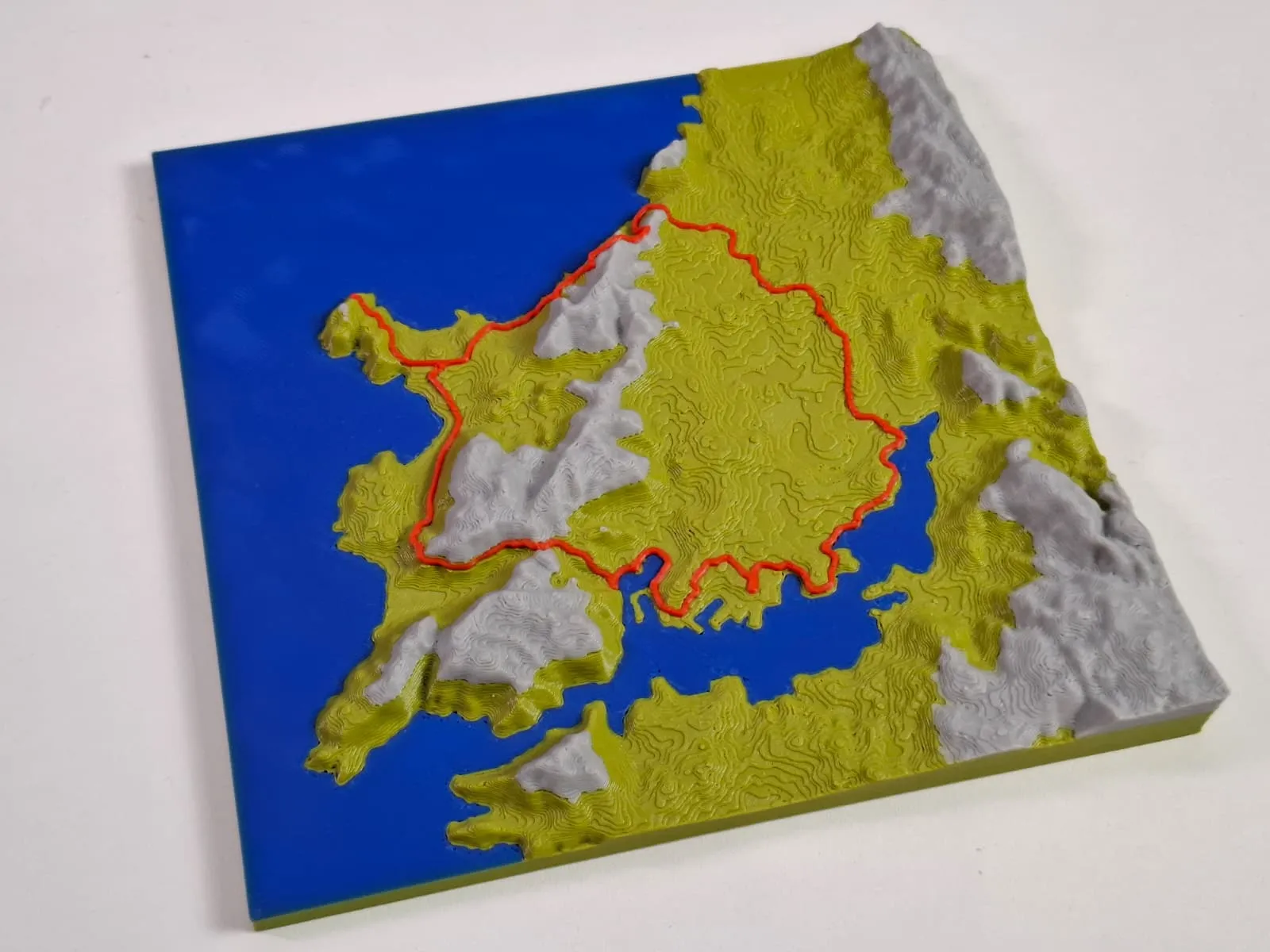
Quick answer: Download your Komoot tour as a GPX file, then load it into TrailPrint3D — a free Blender add-on that builds a real terrain model around your route and exports it as STL or 3MF for printing.
Step 1 — Export your Komoot tour as a GPX file
You'll need a free Komoot account for this step.
- Open the tour on komoot.com (or in the app), under your Profile's Saved routes or Completed activities.
- Select the tour and choose Download GPX file from its options. The file downloads straight to your device.
- Komoot unlocks GPX export for the region your tour starts in. If you're outside your unlocked region(s), it'll tell you which region needs unlocking before you can export that tour.
Step 2 — Generate the 3D terrain with TrailPrint3D
- Install Blender (free) from blender.org, then install the free TrailPrint3D add-on.
- Open the Map Generator. It opens as an interactive map in your browser — click Import GPX and select the file you exported from Komoot. Your route draws onto the map and the area snaps around it automatically.
- Pick a shape and size — square, circle, hexagon, jigsaw puzzle, or your own imported SVG outline — then adjust to taste.
- Send to Blender. One click generates the terrain — real elevation data for the area, built into a 3D mesh that follows your exact Komoot route (climbs, descents, and all), with automatic landscape coloring, buildings, and roads if you want them.
Step 3 — Export and print
Export your finished model as STL, OBJ, or — using the free 3mf Blender add-on — a multi-color 3MF ready for Bambu Studio, PrusaSlicer, or OrcaSlicer. From there it's a normal 3D print: pick a filament (see our filament recommendations) and slice as usual.
FAQ
Can I 3D print my Komoot tour without Blender?
TrailPrint3D runs as a Blender add-on, so Blender (free) is required. In exchange, you get full control over elevation scale, shape, colors, and export settings — not just a fixed online template.
Do I need to pay to export a GPX file from Komoot?
Exporting GPX itself is free, but Komoot ties it to its region-unlock system: you get one region free, and tours outside it need that region unlocked (one-time purchase or a Komoot subscription) before you can download their GPX file.
Can I use a Strava, Garmin, or other GPS app route instead of Komoot?
Yes. TrailPrint3D works with any standard GPX file, regardless of which app or device recorded it. See our Strava to 3D print guide if that's where your route lives.
Will the print show real mountains and elevation, or just my route line?
Real elevation. TrailPrint3D builds an actual terrain mesh from elevation data around your route, so climbs and descents are physically represented in the print, not just marked on a flat surface.