GPX to STL & 3MF Converter
Turn a GPX hiking, running, or cycling track into a real, 3D-printable terrain model — not just the flat line of your route, but the actual mountains, valleys, and elevation it crosses.
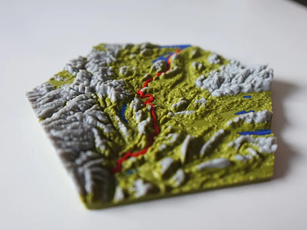
Quick answer: TrailPrint3D is a free Blender add-on that converts a GPX file into a fully colored 3D terrain model built from real elevation data, then exports it as an STL or 3MF file ready for any slicer. Download TrailPrint3D for free — no account, no upload, no watermark.
STL vs. 3MF — which one should you export?
STL is the simplest, most universal 3D printing format: a single mesh with no color or material info. It works in every slicer ever made, which makes it the safest choice if you just want one solid-color terrain print.
3MF is the modern alternative — it can hold several objects, colors, and materials in a single file. If your map has separate color regions (water, forest, buildings) or a multi-color trail, 3MF lets your slicer (Bambu Studio, PrusaSlicer/OrcaSlicer) keep those parts separate automatically instead of you re-assembling loose STL files by hand.
TrailPrint3D exports both: STL and OBJ natively, and 3MF through the free 3mf Blender add-on by Clonephaze (free, and installable with one click from inside the TrailPrint3D add-on).
How to convert a GPX file to STL or 3MF
- Install Blender. Blender is free and open-source — get it from blender.org (version 5.1 or higher).
- Install the TrailPrint3D add-on. Grab it free from the download page or from GitHub.
- Open the Map Generator. It launches as an interactive map in your browser — click Import GPX and select your file. Your trail draws onto the map and the area snaps around it automatically.
- Pick a shape and size. Rectangle, square, circle, octagon, or your own imported SVG outline, then adjust the area to taste.
- Send to Blender. One click generates the terrain tile — real elevation data for the area, built into a 3D mesh following your actual route, with coloring already applied.
- Export. Export directly as STL or OBJ, or use the Clonephaze add-on to export a multi-color 3MF ready for your slicer.
Why a Blender add-on?
TrailPrint3D runs entirely on your own computer, inside Blender. That brings a few things you won't give up once you're used to them:
- No tracking. Your GPX files never leave your machine — where you hike, ride, or run stays your business.
- No account. Install it and start generating. No sign-up, no login, no email address.
- No limits. No daily quotas, no credits, no queue. Generate as many maps as you like, as large as your hardware can handle.
- Can't be shut down. Once it's installed, it's yours. No server that can go offline, no service that can disappear or change its terms.
- Open source. The code is public on GitHub — anyone can read it, learn from it, or improve it.
- Full control. Every model is a regular Blender scene. Tweak the terrain, colors, text, and shape, or edit the mesh by hand before you export.
FAQ
Is there a free way to convert GPX to STL?
Yes. TrailPrint3D's core add-on is completely free and exports STL (and OBJ) directly — no account, no file uploads, no watermark. It runs locally inside Blender.
Can I convert a GPX file directly to 3MF?
Yes, via the free 3mf Blender add-on by Clonephaze, which TrailPrint3D integrates with for multi-color/multi-object 3MF export.
Do I need Blender experience to do this?
No. TrailPrint3D handles the terrain generation and export for you through its own browser-based Map Generator — you don't need prior Blender modeling skills, just the free software installed.
Will the STL include real elevation, or just a flat extruded line?
Real elevation. TrailPrint3D downloads actual terrain height data for the area around your GPX track and builds a true 3D terrain mesh, not a flat shape with the route stamped on top.